We're loading the full news article for you. This includes the article content, images, author information, and related articles.
In a bid to resolve perennial land disputes and modernize urban planning, Kirinyaga County has launched a comprehensive digital mapping and geo-referencing initiative.
In a revolutionary move designed to permanently resolve perennial land disputes and modernize urban planning, the Kirinyaga County Government has launched a comprehensive digital land mapping and geo-referencing initiative across its major urban centers.
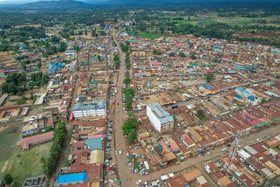
This ambitious technological rollout targets rapidly expanding towns including Kutus, Wang'uru, Kianyaga, Kerugoya, Baricho, Kagio, and Sagana. By digitizing the earth beneath its citizens' feet, the county is taking a decisive stand against the entrenched cartels that have long manipulated analog land records for illicit gain.
For decades, land ownership in Mount Kenya has been a volatile and often bloody issue. The reliance on archaic, paper-based registries has created a fertile breeding ground for corruption. Unscrupulous officials and land grabbers routinely orchestrated the "disappearance" of files, leading to overlapping title deeds, protracted court battles, and the violent eviction of rightful owners.
The introduction of geo-referencing fundamentally alters this landscape. By utilizing advanced satellite imagery and precise GPS coordinates to demarcate plot boundaries, the digital system creates an immutable, tamper-proof record of ownership. Once a plot is mapped and uploaded to the secure database, it becomes virtually impossible for cartels to alter boundaries or forge secondary titles.
This digital transparency restores faith in the system, providing absolute security of tenure to local residents and shielding vulnerable families from the predatory tactics of land speculators.
Beyond dispute resolution, the mapping exercise is a powerful catalyst for economic development. Kirinyaga's urban centers are experiencing rapid population growth, demanding better infrastructure and organized housing. Without accurate spatial data, urban planning has been haphazard, resulting in chaotic development and strained public utilities.
The geo-referenced data allows the county to effectively zone areas for commercial, residential, and industrial use. It enables the precise planning of roads, drainage systems, and public spaces. Crucially, secure, verifiable land titles unlock dead capital. Property owners can now confidently use their verified digital titles as collateral to secure bank loans, injecting fresh capital into local businesses and driving entrepreneurship.
Kirinyaga's initiative serves as a highly successful model for other devolved units grappling with similar administrative nightmares. The transition from chaotic paper registries to streamlined digital ecosystems is the hallmark of modern governance.
As the mapping teams deploy across Kutus and Kerugoya, the county administration has urged residents to cooperate fully, assuring them that the process is designed solely for their protection. This project marks the dawn of a new era in Kirinyaga—one where property rights are absolute, urban growth is structured, and the shadows where cartels operate are permanently illuminated by technology.
"By digitizing our land records, we are not just drawing lines on a map; we are securing the economic future of every family in Kirinyaga County."
Keep the conversation in one place—threads here stay linked to the story and in the forums.
Sign in to start a discussion
Start a conversation about this story and keep it linked here.
Other hot threads
E-sports and Gaming Community in Kenya
Active 9 months ago
The Role of Technology in Modern Agriculture (AgriTech)
Active 9 months ago
Popular Recreational Activities Across Counties
Active 9 months ago
Investing in Youth Sports Development Programs
Active 9 months ago


