We're loading the full news article for you. This includes the article content, images, author information, and related articles.
Nairobi County has released a guide calling for clearly defined boundaries around State House, JKIA, Wilson Airport and nearby military installations. Officials say the new demarcations will improve revenue collection
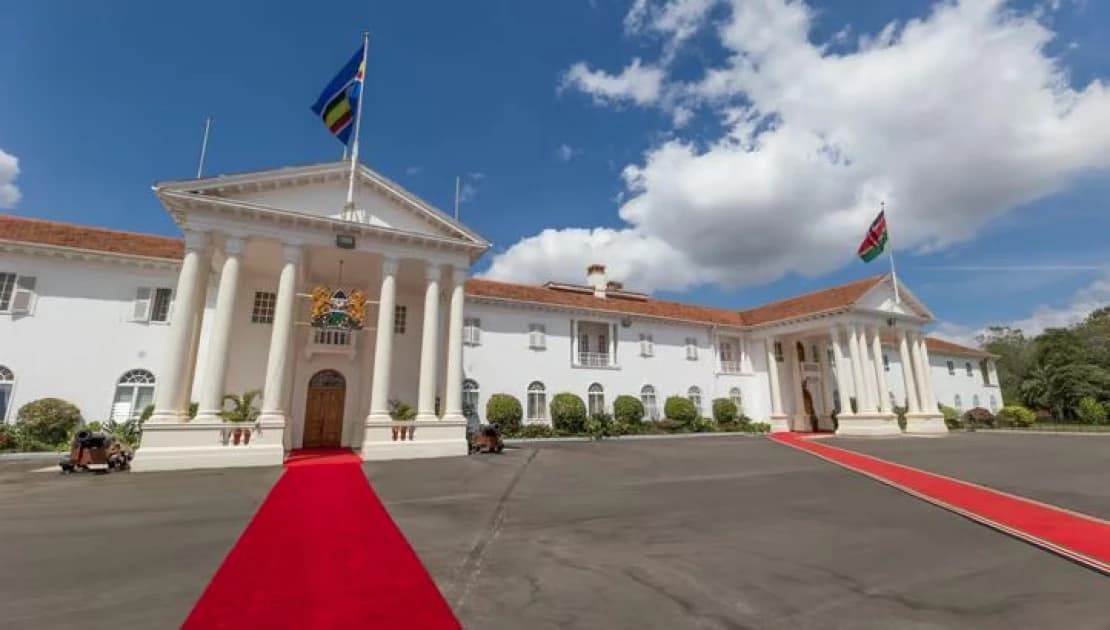
Nairobi, Kenya — 2025-09-12 15:30 EAT. Nairobi County Government has proposed a planning guide aimed at clearly demarcating boundaries for critical national installations to avoid development conflicts, revenue disputes, and security concerns. These include State House, JKIA, Wilson Airport, Langata and Kahawa barracks, Moi Air Base and other military, aviation, and state facilities.
What happened now: Nairobi County’s City Planning Department issued a notice calling for precise boundary definitions around national installations.
Why it matters: The lack of defined borders has created overlaps in jurisdiction between county authorities and national agencies, leading to disputes over development permissions, levies, rates, land use, and enforcement.
Status: Proposal/guide issued; under stakeholder consultation.
Nairobi is dense and urban pressure places development adjacent to state/military installations. Without clear demarcations, private developers may build in zones affecting operations or security.
Legal frameworks (Physical and Land Use Planning Regulations, 2021) and county development planning require clarity in boundaries and zoning.
Relevant laws/regulations:
• Physical and Land Use Planning (General Development Permission and Control) Regulations, 2021 (Legal Notice 253) require that developments around strategic installations be referred for verification and compatibility.
• Nairobi County Integrated Development Plan (CIDP) sets priorities for spatial planning, zoning, infrastructure management.
Mandates:
• County Government (City Planning Department) handles planning approvals, zoning, and development control within County boundaries.
• National agencies (Defence, Transport, Aviation, etc.) oversee operations of installations like airports, barracks, airbases.
What should happen next per policy:
County to consult with national agencies to define exact legal boundaries of installations.
Updating zoning maps and development control policies to reflect these boundaries.
Harmonizing permit, rate, and fee collection structures where jurisdictional overlaps exist.
Ensuring changes are gazetted so that stakeholders — developers, residents, security agencies — are informed.
Nairobi County Government / City Planning Department: Driving the boundary-definition guide to reduce disputes and increase planning clarity.
Developers & Land Owners: Likely to benefit from clarity around where county authority ends and national agency involvement begins.
National Agencies (Defence, Aviation, Transport): Will need to coordinate to set or confirm boundaries.
Residents and local political units: Could be impacted (ward/constituency assignments, service delivery, permits) once boundaries are formalized.
|
Item |
Detail |
|---|---|
|
Proposal |
Nairobi County Seeking to define precise boundaries around national/state installations such as JKIA, State House, military barracks, airports, etc. |
|
Current issue |
Overlaps in jurisdiction over development control, revenue (rates), business permits, enforcement etc. |
|
Legal backing |
Physical & Land Use Planning Regulations, 2021 (Legal Notice 253) require verification of compatibility for developments near strategic installations. |
Administrative friction: Possible resistance from national agencies used to de facto control over certain buffer zones.
Revenue loss / gain: Clarification may affect which authority collects rates or permits in grey areas, potentially changing revenues.
Political/constituency changes: If zones fall under new jurisdiction, residents/employees in those zones might be reassigned ward/constituency, affecting voting registration and local service jurisdiction.
Security implications: Clearer boundaries help reduce security risks associated with encroachment near sensitive installations.
The precise boundary lines as proposed or under consideration.
Whether existing residents or businesses in affected overlap zones will be reclassified, compensated, or grandfathered.
How and when mapping, surveying, and legal gazetting will happen.
What the timeline is for implementation and enforcement.
How resident or stakeholder consultation will proceed and how objections will be handled.
|
Date |
Event |
|---|---|
|
December 2021 |
Physical & Land Use Planning Regulations, 2021 enacted (Legal Notice 253) outlining development control rules around strategic installations. |
|
2023-2027 |
Nairobi CIDP period where zoning, planning, and land use are priorities. |
|
Sept 2025 |
Nairobi County releases planning guide / calls for precise boundary definitions. |
Publication of maps or cadastral delineations for the installations.
Formal gazetting of boundary definitions.
Updates to zoning maps, development permit workflows to incorporate new boundaries.
Feedback or objections from national security institutions or residents/businesses in overlap zones.
Keep the conversation in one place—threads here stay linked to the story and in the forums.
Sign in to start a discussion
Start a conversation about this story and keep it linked here.
Other hot threads
E-sports and Gaming Community in Kenya
Active 9 months ago
The Role of Technology in Modern Agriculture (AgriTech)
Active 9 months ago
Popular Recreational Activities Across Counties
Active 9 months ago
Investing in Youth Sports Development Programs
Active 9 months ago


