We're loading the full news article for you. This includes the article content, images, author information, and related articles.
A dual weather catastrophe strikes Europe as Storm Leonardo floods the south and Arctic air freezes the north, displacing thousands and paralyzing infrastructure across the continent.
A relentless conveyor belt of Atlantic storms has plunged Europe into a deepening crisis. From the flooded streets of Lisbon to the snow-choked railways of Scandinavia, the continent is grappling with a dual assault of catastrophic flooding and bone-shattering cold that shows no sign of abating.
The meteorological map of Europe is currently a canvas of extremes. In the south, Storm Leonardo has unleashed a deluge of biblical proportions, forcing the Portuguese government to extend a state of emergency as river banks burst and landslides sever critical infrastructure. Meanwhile, the north is gripped by a "deep freeze" driven by a displaced polar vortex, sending temperatures plummeting to levels not seen in a decade. It is a tale of fire and ice, or rather, flood and frost, that has paralyzed economies and displaced thousands.
This weather phenomenon is not a freak accident but the result of a "blocked" atmospheric pattern. A stubborn high-pressure system over Scandinavia is channeling freezing Siberian air westward, while simultaneously forcing low-pressure storm systems to track further south than usual, slamming directly into the Iberian Peninsula. The result is a humanitarian emergency on two fronts: millions are shivering in unheated homes due to energy spikes, while others are watching their livelihoods wash away in torrents of mud and water.
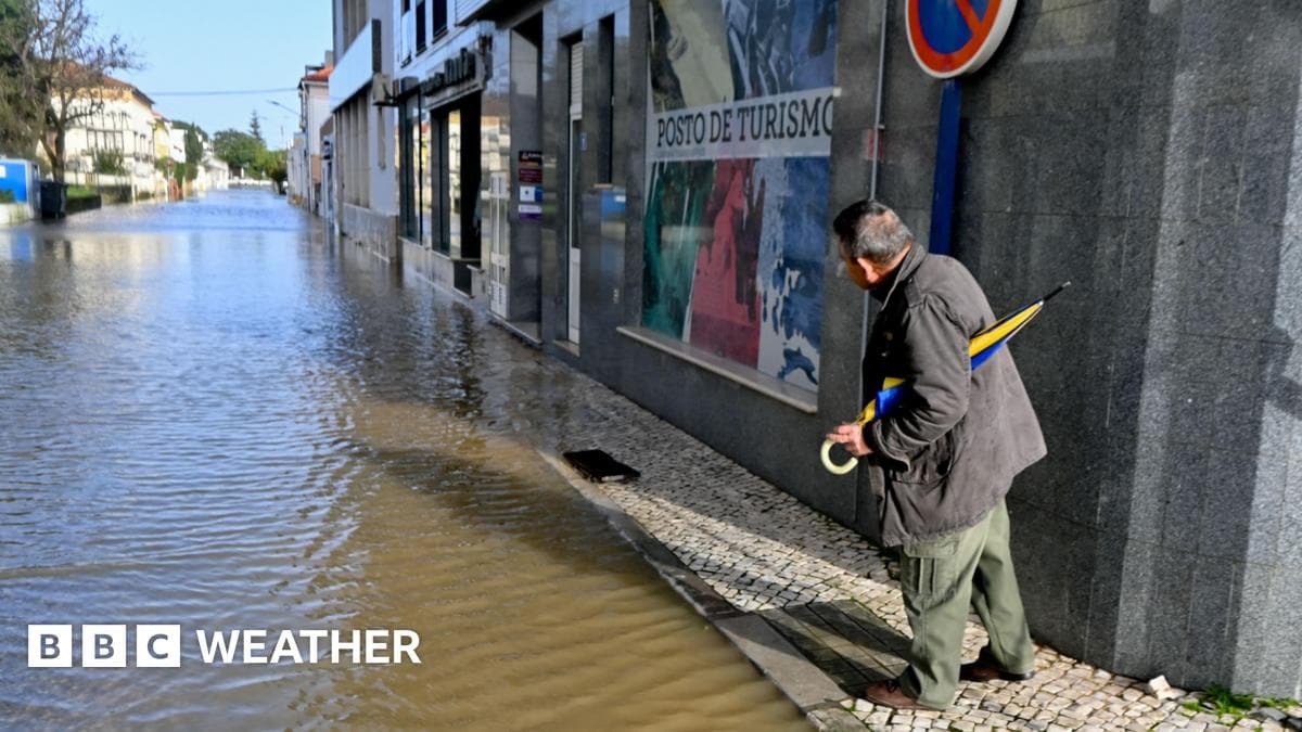
Portugal and Spain are bearing the brunt of the wet onslaught. In the Algarve, usually a haven for winter sun-seekers, emergency sirens have become the soundtrack of the week. The "devastating crisis," as described by Lisbon officials, has seen 3,500 people evacuated in Andalucia alone. The Tagus and Douro rivers have breached their banks, turning historic town centers into brown, swirling lagoons.
The infrastructure toll is mounting. Over 100 major roads remain closed across the peninsula, and high-speed rail links between Madrid and Lisbon have been severed. "We have not seen rain like this in fifty years," remarked a civil protection officer in Seville. " The ground simply cannot drink anymore." With Storm Marta forecast to make landfall this Saturday, bringing fresh waves of rain to already saturated ground, the worst may yet be to come.
Meteorologists point to a "Sudden Stratospheric Warming" event that occurred weeks ago as the invisible architect of this chaos. This phenomenon, which takes place 30 kilometers above the Earth, disrupted the polar vortex, reversing the zonal winds and allowing cold Arctic air to spill southwards. It is a delayed reaction—a butterfly effect on a planetary scale—that is now freezing pipes in London and burying cars in Munich.
As Europe battens down the hatches for another week of extremity, the resilience of its infrastructure is being tested to the breaking point. The "new normal" of climate volatility is no longer a future prediction; it is the freezing water rising in a Portuguese basement and the ice forming on a British windowpane. For now, the continent waits, watches, and shivers.
Keep the conversation in one place—threads here stay linked to the story and in the forums.
Sign in to start a discussion
Start a conversation about this story and keep it linked here.
Other hot threads
E-sports and Gaming Community in Kenya
Active 9 months ago
The Role of Technology in Modern Agriculture (AgriTech)
Active 9 months ago
Popular Recreational Activities Across Counties
Active 9 months ago
Investing in Youth Sports Development Programs
Active 9 months ago


